Thursday

This IS real snow!


Chiricahua National Monument in southeast Arizona is a rock lovers dream. The pinnacles gave us just hint of what the geological features to come over the next few thousand miles of our journey through Arizona and New Mexico. 


Lots of signs for coati but we never saw one

Stock photo of a coati - they are related to a raccoon

We stopped by the visitor center to enquire about the road conditions and good trails to hike, and were warned that though the roads were clear, there would still be snow at the top. We decided to go anyway, and hiked the Sugarloaf trail to the top of Sugarloaf Mountain to see the fire lookout. Although it was only 1.8 mile return and a climb of 470 feet, it was a bit of a slog due to the snow and slippery sections, so it took us close to two hours to complete - but well worth it for the amazing views!


Lovely hike, but a bit slippery in places

And cold! Down jacket for me was a must


Red berries from last year - so pretty against the white snow


We made it to the fire lookout at the top

Views from the top were spectacular


Snow day?


Not snow! The sand at White Sands National Park in south-central New Mexico looks so much like snow in the photos, even we could be fooled - and we were there!


The day we were at White Sands, a fresh breeze was blowing, and it was so cool to walk along the sand dunes, and look behind us… just moments after we had left our footprints, they vanished in the wind.


The white sand is actually fine particles of gypsum, which maintains a cool temperature even on the hottest days of summer. At 265 square miles, the gypsum dunefield at White Sands is the largest its kind on Earth!


No ice here!


Just loved the desert brush on the white sands!


The park is completely surrounded by the White Sands Missile Range, and we noted signs as we were driving through that warned of unexpected road closures due to missile testing. Thank goodness we were there when they were taking a break from firing missiles all over. did you know that White Sands Missile Range was also one of the key locations of the Manhattan Project? The first atomic bomb was developed  here during world War II. which developed the first atomic bomb during World War II. Testing of the first atomic bomb took place just north of the park.

There is a very interesting museum on the grounds of the White Sands Missile Range, which we visited. We had to get clearance, and that meant we had to provide our passports and have photo ID taken prior to entering the military base. It was all very official, though I wonder if it was all just for show? It seemed just too easy, and the guards were just too friendly!


Missiles on display outside the museum


Monday

Three Rivers Petroglyphs


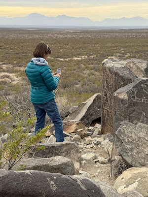
On our way to White Sands National Park, we spied a sign directing us to the Three Rivers Petroglyphs site just outside of Tularosa, New Mexico.


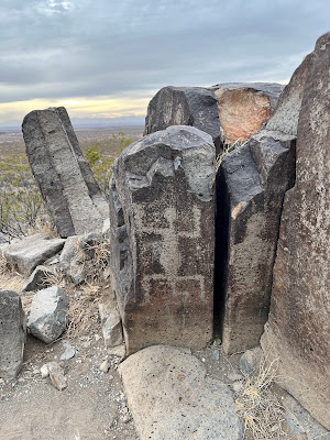
Petroglyphs? I’m in! So we veered off the main road and drove 36 kilometres to a national park that contains over 21,000 (!!!!!!) petroglyphs. 


Big horn sheep


Big horn sheep with arrows

Human face


Bird


Fish?


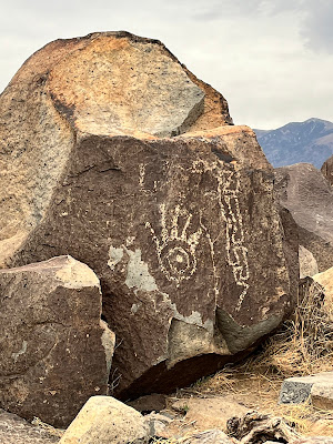
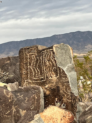
I was in archaeological heaven! I could have spent days looking at all the masks, sunbursts, handprints, animals, birds, humans, fish, and geometric designs that date back to between 200 - 1450 CE. I tried to take photos of all 21, 000 petroglyphs. I really did. D had to lure me away with the promise of fresh pistachio nuts from a local farm. That was the only way he could get me to leave!


World's largest pistachio in Alamagordo, New Mexico

Archaeologists today have only the faintest ideas of what these petroglyphs mean. Could it be ancient graffiti? The first form of colouring or drawing book? Scholars suspect the petroglyphs are religious in nature, and may also tell stories of daily life, myths and events of significance.


Visitor from outer space? Three Rivers is not that far from Roswell...

Oh, to be able to go back in time to find out what these people really were thinking…